

Nikon D800
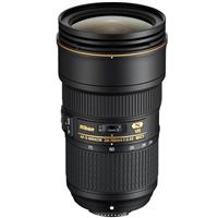
Nikon AF-S FX NIKKOR 24-70mm f/2.8E ED Lens
Badwater Basin in Death Valley National Park

@veekster
Crystalized by the natural cycle of rain and evaporation, the dried salt covering this Death Valley basin is a sight like no other. The cracking surfaces weave in and out over the salt flats and as you walk through the basin, you'll find yourself at the lowest point in North America — a staggering 282 below sea level!
Plan
Overview
Skill level
Moderate
Accessbility
Public Location
Hours
Anytime
Fee
Pack
- Wide-angle lens (24mm)
- Model
- Walking shoes
- Water
How to get there
N36° 13' 54.6096"W116° 47' 55.7628"
The Badwater Basin in Death Valley National Park can be accessed by car, but for this particular shot, I reached this location via a private helicopter. While we flew over the basin in the helicopter, we picked the location where we wanted to land and then I walked to where I took this shot.
The basin is 5-miles in total surface area and I stood at (36.2331, -116.8380), but if you don't have access to a helicopter, you can get the same view from (36.231836, -116.798823), which is about 1/4 mile from the main visiting area. Park in the lot (36.229873, -116.767280) and then follow the signs that lead to the Badwater Basin.
According to the National Park website, "Badwater Basin is located 30 minutes south of the Furnace Creek Visitor Center. Most visitors will choose to drive to Badwater, view or hike on the salt flat, and then return north on Badwater Road the way they drove in. This would require the minimum time of one hour. If you are interested in hiking longer, just add the amount of time you would like to spend on the salt flat".
For more information, check out their website:
https://www.nps.gov/thingstodo/visit-badwater-basin.htm
Tips
Get more with
explorest pro
Learn more about the locations and
how to get the best pictures including:
Best times to go
Current weather conditions and times around twilight
Field tips
Gear used & photo settings
What to do nearby

Locations nearby


