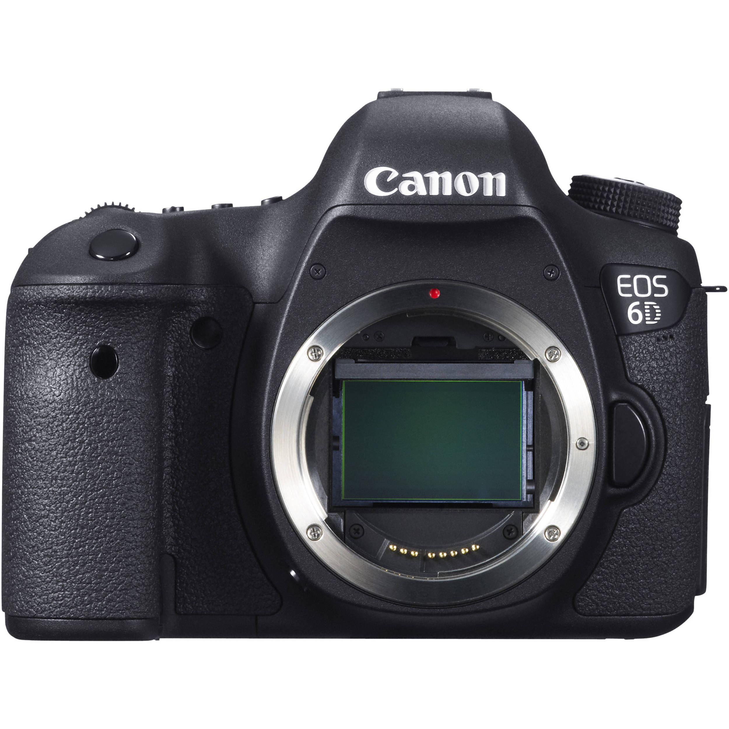
location-photo
camera
len
Canon EOS 6D
Tamron 18-270mm F/3.5-6.3
Shutter Speed
1/1250 sec
Aperture
f/6.3
Focal Length
270mm
ISO
100

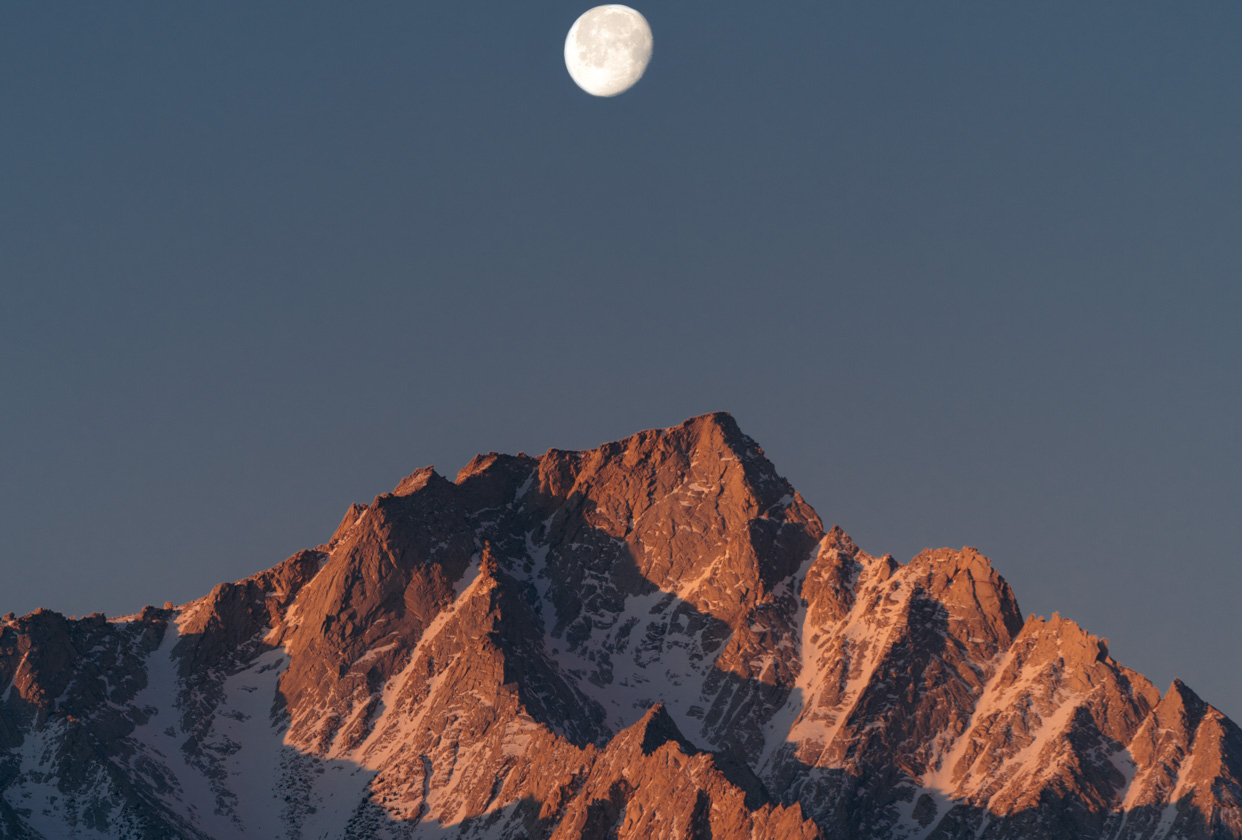
Inyo Mountains view of Mount Whitney

avatar
@peteracarey
Everyone has seen Mount Whitney from Highway 395 or the Alabama Hills outside of Lone Pine, but the view from the Inyo Mountains is a unique one all on its own! The solitude in this place in particular contrasts greatly to the "hustle and bustle" one often experiences at the Alabama Hills.

Plan

Overview

Skill level

Difficult
Accessbility
Public Location

Hours

Anytime

Fee

Free

Pack

  • Telephoto lens (270mm)
  • Tripod
  • Shoes and clothing for short off-trail hike
  • Attire and gear appropriate for weather conditions
  • Water

How to get there

N36° 42' 13.4676"W118° 01' 00.8004"
This spot if off the beaten path, and requires some off-road travel on a narrow two-track road lined by creosote and other desert plants. Road conditions can change from year to year and 4-wheel drive may be required. At the very least, a high clearance vehicle is recommended to make sure your hike isn't longer than it needs to be. Make your way on Highway 395 to Lone Pine, CA. At the north end of Lone Pine, turn right (east) on Lone Pine Narrow Gauge Rd. At 2.5 miles in there will be a fork, stay left to stay on Lone Pine Narrow Gauge Rd. You will come to another fork in 0.5 miles, stay left to continue on Lone Pine Narrow Gauge Rd. The road will angle into Owenyo Lone Pine Rd 0.4 miles later and you will continue north (left at the intersection) for 4.6 miles. The road was once paved, but has since become more of a paved/graded road. It is still in good condition. At the 4.6 mile mark, you will make a right turn on an unnamed, unmarked two-track road. The road is located at a point where a former canal (now just a dry ditch) that has been paralleling Owenyo Rd on the east makes a 90 degree west turn crossing Owenyo Rd. This road is a two-track road and it is not maintained. Shortly after turning on the road (after ~700 feet), you will cross over another canal (also dry) and the road will make a right and head south for about 300 feet before a small fork in the road, continue to the left (east). In total, the road is about 2 miles long and heads up the alluvial fan toward the Inyo Mountains. At about the 1.7-mile mark there is another fork, continue straight (right fork). A quarter mile or so later the road will end where it has been washed out by a large drainage. Park there (or anywhere you are able to park before that). From there, you will hike up the drainage which has washed out the road for about a quarter mile before coming to a confluence with another minor drainage coming from the south. Continue straight up the ridge in front of you that is isolated by those two drainages. You will hike up that ridge for approximately 1,100 feet and a little over 400 feet in elevation gain. All the while a ridge to the west of you will block your view of the Sierra. Once you reach the GPS coordinates, turn around and Mount Whitney will be visible through a notch in the ridge!

Tips

When to go

Best season

January, February, March, December

Best time

Sunrise, Morning
Although the Sierra Nevada mountains look great all times of the year, they look spectacular from the Inyo Mountains when they are covered in snow. Choose a time in winter after there's been a storm (preferably a cold one so the snow line is low).
The shot was taken early morning after sunrise, but sunrise would be a great time to get a similar shot!

Field tips

Some safety tips: Since this is out of the way and requires not only off-road travel, but also a small hike, make sure you have let someone know where you plan on being. There should be cell phone service, but it is not a guarantee. Also, make sure you have water in the car and with you. Though the hike is short, there is no trail and the terrain can be rocky and loose, especially in the drainage where there are some steep cuts and large boulders. Be aware of your surroundings. Finally, do not attempt this if there is any chance of thunderstorms, flash floods are always a possibility in these types of areas.
Be sure to take into account the time it will take you to both drive and hike to the location so you don't miss the light you want. From Lone Pine, it will likely take a half hour or more to get to the parking spot, then the hike from there could take anywhere from 10 to 20+ min depending on how fast you hike, amount of gear, etc.
A telephoto lens is a must for this shot, otherwise you will just have a picture of a ridge blocking most of you view of the Sierra with a small Mount Whitney peaking through a nondescript notch. Zoom in and create the illusion that Mount Whitney is large and in charge! And make sure to have a tripod to keep that camera steady!
Expose for Mount Whitney only. The mountain will be in the light, while the ridge in the foreground will still be shaded. Exposing for the lit Mount Whitney will create a silhouette of the ridge which will frame the main subject (hint: Mount Whitney).

Current weather

Owenyo, California
Clear
63o
F
Mon
70o
53o
Tue
74o
55o
Wed
80o
58o
Thu
72o
54o
Fri
72o
55o

Blue Hour

12:04
63o
Clear

Sunrise

12:35
63o
Clear

Golden Hour

02:37
63o
Clear

Sunset

03:15
63o
Clear

Do nearby

After getting the shot you want, head back to the car and start the drive out. You can check out the remains of Owenyo, a former South Pacific narrow guage rail station and town site, along Owenyo Lone Pine Rd. Once you get back to Owenyo Lone Pine Rd. turn left and about 1.3 miles down the town site will be on your right. There are no buildings anymore, but the traces of a past life are still everywhere!
You can also head into Lone Pine for a great meal at the Alabama Hills Cafe, or even just head into the Alabama Hills and check out some other photo stops.

Locations nearby

location-nearby
location-nearby
location-nearby