
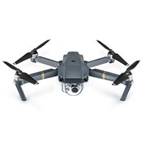
DJI Mavic Pro
Built-in Lens
Riverside Park South, Joe DiMaggio Highway & Upper West Side Skyline

@gmp3
Plan
Overview
Skill level
Easy
Accessbility
Public Location
Hours
Anytime
Fee
Free
Pack
- Drone
How to get there
N40° 46' 24.6684"W73° 59' 36.6216"
This image was taken of Riverside Park South and the Joe DiMaggio Highway, facing north. I stood at the southend of the park and launched my drone from there. Reference the GPS coordiante.
By Subway:
- Closest Station: 66th St Lincoln Center (1 or 2 Train)
- Walk south on Broadway until you reach Columbus Ave, then turn right
- Turn right on 59th Street and walk toward the Hudson River
- Once you get to the waterfront, walk south until you're at the end of the park
Tips
Get more with
explorest pro
Learn more about the locations and
how to get the best pictures including:
Best times to go
Current weather conditions and times around twilight
Field tips
Gear used & photo settings
What to do nearby

Locations nearby


