
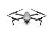
DJI Mavic 2 Pro
Built-in Lens
Downtown Seattle Skyline from Ferry Waiting Zone
@samhorine
Plan
Overview
Skill level
Moderate
Accessbility
Public Location
Hours
Anytime
Fee
Free
Pack
- Drone
How to get there
N47° 35' 59.118"W122° 20' 11.022"
This drone image was taken from the Ferry Waiting Zone, looking northeast onto Downtown Seattle. To get there, you can drive, bike, walk or take public transportation.
By public transportation:
- Closest station: S Jackson St & Occidental Ave Walk (via First Hill Streetcar)
- Head west on S Jackson
- Turn right onto Seattle Waiting Zone
Address:
Ferry Waiting Zone, Seattle, WA 98104
Tips
Get more with
explorest pro
Learn more about the locations and
how to get the best pictures including:
Best times to go
Current weather conditions and times around twilight
Field tips
Gear used & photo settings
What to do nearby

Locations nearby


