
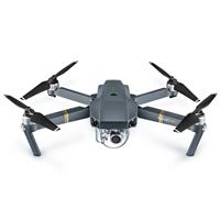
DJI Mavic Pro
Built-in Lens
Hong Kong City Look Down from Lugard Road

@bemorephotos
Head to one of Hong Kong's most iconic lookout points over the city for the perfect spot to fly your drone high above the towering skyscrapers. This popular walking path affords incredible vistas of Victoria Harbour, offering clear, unobstructed views for traditional, or drone, photography.
(before flying a drone, check and follow local drone regulations and permit requirements)
Plan
Overview
Skill level
Moderate
Accessbility
Public Location
Hours
Anytime
Fee
Free
Pack
- Drone
How to get there
N22° 16' 41.3688"E114° 08' 48.4656"
This aerial photo of Hong Kong was taken from Lugard Road Lookout, a lookout along a popular walking path on Victoria Peak, which is a part of Hong Kong Trail. To get here, take a taxi or public transportation up to The Peak.
From The Peak Galleria, walk down Lugard Road heading west. Follow the pedestrian road for 20 minutes until you reach an opening that overlooks the cityscape. You can launch your drone from here, flying it out north over the city, in between Mid-Levels and Central.
By MTR:
- Closest MTR Station: Central Station
- Exit "J2" and walk to the Lower Peak tram terminus located on Garden Rd for the scenic ride up to The Peak
By Bus:
- Take Bus 15 from Exchange Station bus terminus, or Minibus 1 from MTR Hong Kong Station public transport interchange.
Tips
Get more with
explorest pro
Learn more about the locations and
how to get the best pictures including:
Best times to go
Current weather conditions and times around twilight
Field tips
Gear used & photo settings
What to do nearby

Locations nearby


